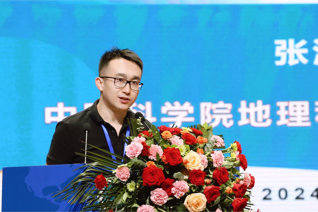
張海平,男,甘肅蘭州人,1989年生,博士,民盟盟員。中國科學院地理科學與資源研究所副研究員,碩士生導師。
基本介紹
人物經歷,主要成就,研究方向,學術貢獻,所獲榮譽,主要著作,代表性學術期刊論文 (*為通訊作者),
人物經歷
2020年博士畢業於南京師範大學地理科學學院,獲得理學(地理學)博士學位。2020-2023年在南京師範大學數學科學學院從事博士後研究工作。2023年9月入職中國科學院地理科學與資源研究所,2024年12月被評為副研究員,碩士生導師。
主要成就
發表學術論文 50 余篇,含 SCI/SSCI 論文 43 篇。其中一作/通訊作者論文 28 篇,主要發表在地理學綜合性頂尖期刊 Annals of AAG、地理信息科學領域頂尖期刊IJGIS和 Geographical Analysis、人文地理學高水平期刊 Cities 和 IJHM,及其它地理信息科學高水平期刊如 GIS&RS ,CaGIS ,IJDE ,GSIS ,TGIS,Applied Geography,地理學報,地理研究、地理與地理信息科學等領域內主流雜誌。2024知網地理學領域TOP5%高被引學者。領銜開發了一整套社會地理過程分區與模擬的方法模型與工具集。主持國家自然科學基金青年項目(C 類)、國家重點研發子課題等項目。作為主要作者出版地理信息理論、方法與套用教材和專著三部,參編教材一部。
研究方向
主要從事地理信息科學理論與方法研究,及其在人文地理學中的套用研究。目前聚焦於社會地理計算、地理分區、海運大數據與世界地理方面的科研工作。
學術貢獻
提出了基於序列刻畫位置固定對象“時變過程”和位置移動對象“互動過程”的表達模型,解決了從時空數據中提取可解釋高階特徵的難題,提升了GIS 對社會地理過程的建模能力。提出“地理過程分區”的概念與基本思想,研發了相應的方法與工具,將傳統靜態空間分區拓展為時空耦合的動態過程分區新範式,突破了傳統方法忽視時間維度的局限,為深入理解和分析地理過程提供了新的視角與方法。研製了引入個體空間認知和跨尺度的社會地理過程動態模擬方法,增強了模擬過程的真實性,提升了 GIS 對複雜社會過程的仿真能力,為人口、文化和經濟等社會要素的趨勢預測與機理探索提供了更有效的技術支持。
所獲榮譽
全國高校“GIS新秀”獎, 國家地理信息系統工程技術研究中心;高等院校地理信息系統(GIS)論壇組委會 , 2018
全國十大城市數據師個人貢獻獎, 城市數據派,2016
國家優秀教材二等獎, 國家教材委員會, 國家二等獎, 2021. (湯國安; 劉學軍;閭國年; 盛業華; 王春; 張海平)
2023 易智瑞杯中國大學生 GIS 軟體開發競賽優秀指導老師獎(學生一等獎), 中國測繪學會, 2023
2022 易智瑞杯中國大學生 GIS 軟體開發競賽優秀指導老師獎(學生一等獎),中國測繪學會, 2022
地理信息分析理論與方法學術年會優秀論文獎,中國地理學會, 2019
2018城市地理學理論與方法學術年會優秀青年論文獎, 中國地理學會, 2018
主要著作
湯國安,劉學軍, 閭國年, 盛業華, 王春, 張海平. 地理信息系統教程(第二版),高等教育出版社,2019.
湯國安,楊昕, 張海平. ArcGIS地理信息系統空間分析教程(第三版), 科學出版社,2021.
閭國年等. 地理信息科學導論, 科學出版社,2022. 參編
張海平. 地名文化信息圖譜:理論、方法與套用. 雲南人民出版社. 2022
代表性學術期刊論文 (*為通訊作者)
- Haiping Zhang,Xingxing Zhou*,Yang Yu,Wang Haoran,Ye Xinyue,Tang Guoan. (2024). Advancing Process-Oriented Geographical Regionalization Model. Annals of the American Association of Geographers,114(10):2388–2413.
- Zitong Li,Haiping Zhang*,Ding Chen,Canyu Chen,Renyu Chen,Nuozhou Shen,Yi Huang,Liyang Xiong,Guoan Tang. (2023). Spatiotemporal transmission model to simulate an interregional epidemic spreading, Annals of the American Association of Geographers,113(9):2084-2107.
- Xingxing Zhou,Haiping Zhang*, Xinyue Ye. (2024). A multi-hierarchical method to extract spatial network structures from large-scale origin-destination flow data. International Journal of Geographical Information Science,38(3):577–602.
- Jinzhao Guo, Haiping Zhang*, Xiang Ye, Haoran Wang, Yu Yang, Guoan Tang. Spatial association measures for time series with fixed spatial locations. International Journal of Geographical Information Science. 2024.
- Haiping Zhang, Xingxing Zhou, Guoan Tang*, Xueying Zhang, Jin Qin and Liyang Xiong. Detecting colocation flow patterns in the geographical interaction data. Geographical Analysis. (2022), 54: 84-103.
- Haiping Zhang, Xingxing Zhou*, Zitong Li, Yushu Xu, Yu Yang, Guoan Tang. An approach for exploring spatial associations in multi-layer networks based on convergent and divergent flow structures. International Journal of Digital Earth. 2024, 17(1):2436478.
- Nuozhou Shen, Haiping Zhang*, Zitong Li & Guoan Tang (2024) Viral invasion, incubation, and outbreak under the normalized operation of urban systems: a spatial cognition-driven transmission model of infectious diseases, International Journal of Digital Earth, 17:1, 2347459.
- Nuozhou Shen.,Haiping Zhang*., Wang,Xiaoxiao.,Li, Zitong., Zhou, Xuanhong., Xu, Chuanxi., & Tang,Guoan. (2024). Advancing indoor risk mapping for virus transmission of infectious diseases through geographic scenario simulation. Cartography and Geographic Information Science, 51(3), 421–444.
- Haiping Zhang,Xingxing Zhou*, Xinyue Ye, Guoan Tang, Haoran Wang and Shangjing Jiang. Strength-weighted flow cluster method considering spatiotemporal contiguity to reveal interregional association patterns, GIScience & Remote Sensing, (2023), 60:1.
- Haoran Wang,Haiping Zhang*, Hui Zhu, Fei Zhao, Shangjing Jiang, Guoan Tang & Liyang Xiong. A multivariate hierarchical regionalization method to discovering spatiotemporal patterns, GIScience & Remote Sensing. (2023), 60:1.
- Nuozhou Shen, Haiping Zhang*, Haoran Wang, Xuanhong Zhou, Lei Zhou & Guo’An Tang. Toward multi-granularity spatiotemporal simulation modeling of crowd movement for dynamic assessment of tourist carrying capacity, GIScience & Remote Sensing. (2022), 59:1, 1857-1881.
- Haoran Wang,Haiping Zhang*, Nuozhou Shen, Fei Zhao,Hui Zhu, Shangjing Jiang, Guoan Tang, Liyang Xiong. A time-series-based model to detect homogeneous regions of residents’ dynamic living habits. Geo-spatial Information Science. 2024.
- Yushu Xu, Haiping Zhang*, Zihan Li, Haoran Wang,Lei Zhou, and Ziye Bao. Integration of migration and attention flow data to reveal association of virtual–real dual intercity network structure. Cities, (2023), 143: 104614.
- Haiping Zhang, Xingxing Zhou, Guoan Tang*, Liyang Xiong, and Kaixin Dong. Mining spatial patterns of food culture in China using restaurant POI data. Transactions in GIS. (2021), 25(2): 579-601.
- Lei Zhou, Haiping Zhang*, Xiangcheng Zhang. Reshaping the central place hierarchy of the urban hotel industry through O2O e-commerce, International Journal of Hospitality Management, (2023), 109:103389.
- Zihan Li, Haiping Zhang*, Yushu Xu, Tianyao Fang,Haoran Wang & Guo’An Tang (2024),How does cultural distance affect tourism destination choice? Evidence from the correlation between regional culture and tourism flow, Applied Geography, Volume 166, 103261.
- Haoran Wang, Haiping Zhang*,Shangjing Jiang, Guoan Tang, Xueying Zhang,and Lei Zhou. City association pattern discovery: A flow perspective by using cultural semantic similarity of place name. Applied Geography. (2022), 139: 102629.
- Haiping Zhang,Xingxing Zhou, Guoan Tang*, Genlin Ji,Xueying Zhang,and Liyang Xiong. Inference method for cultural diffusion patterns using a field model. Transactions in GIS. (2020), 24(6): 1578-1601.
- Haoran Wang, Haiping Zhang*, Guoan Tang, Lei Zhou, and Shangjing Jiang. Inter‐city association pattern recognition by constructing cultural semantic similarity network. Transactions in GIS. (2022), 26(5): 2225-2243.
- Zhang Haiping, Guoan Tang, Liyang Xiong* et al., 2024. Geomorphology-oriented theoretical framework and construction method for value-added DEM. Journal of Geographical Sciences. 34, 165–184.
- 張海平, 湯國安, 熊禮陽*,楊昕,李發源; 面向地貌學本源的增值型DEM理論框架與構建方法研究, 地理學報,2022.
- 張海平, 周星星, 湯國安*, 周蕾等; 基於GIS場模型的城市餐飲服務熱點探測及空間格局分析,地理研究,2020, 39(2): 354-369.
- 顧秋實,張海平*,周星星等.中國傳統八大菜系的地理分布及其擴散效應——基於大數據視角的實證分析.浙江學刊,2019(05):47-53+241-244.
- 張海平*,周星星,代文.空間插值方法的適用性分析初探. 地理與地理信息科學,2017,33(06):14-18+105.
